An architect's guide to land viability, slope, elevation, and what Phuket's hilly centre asks of a design.
Kathu is the part of Phuket most people pass through without stopping. It sits in the west-central core of the island, in Kathu District, in the valley and hills inland of Patong and south of Kamala, and it carries a name long associated with the island’s tin-mining history rather than its beaches. It is one of the few parts of Phuket that is genuinely lived in rather than visited, a working district where locals and longer-term residents settle for the lower land cost and the green, hilly setting away from the coastal congestion.
For someone considering building here, whether a private home, a nature-oriented residence, or a long-term rental property, Kathu presents an unusual combination of value and difficulty. The land is markedly cheaper than the coastal zones. The setting is green and quiet. But the topography is the dominant fact about Kathu: it is hilly, it sits against the protected Nakkerd Range, and the elevation and slope rules that govern Phuket’s hillsides are the decisive constraint on almost any plot here.
This guide is written from an architect’s perspective. It assumes you are at the stage of asking whether Kathu is right for your project, and what a feasible building on land here might actually look like.
Important update before going further
Phuket’s elevation rules changed materially in December 2024, and the detail of that change matters more in Kathu than almost anywhere else on the island. A Cabinet resolution published in the Government Gazette and effective from 14 December 2024 lifted the longstanding prohibition on construction above 80 metres above sea level, now permitting development up to 140 metres above sea level in the designated zone, subject to strict conditions.
The points worth knowing for Kathu specifically:
The relaxed allowance applies to the designated zone that covers most of the island but explicitly excludes the protected Nakkerd Range, and parts of Kathu sit against or within that protected hill range
In the elevation-controlled band, only a single building is permitted per parcel, capped at 6 metres in height with a building footprint limit in the order of 90 square metres
Roughly 70 percent of the plot must remain as green space, with at least half of that green area left unpaved
Land titles in the elevation-controlled zones generally need to have been issued before 2017 to qualify for the new development allowance
The practical consequence for Kathu is that the relaxation does not simply open the hillsides for development. The protected Nakkerd Range is excluded from the relaxed zone, the elevation band that is relaxed comes with single-building and footprint and green-space conditions that constrain what can be built, and the slope rules sit on top of all of it. Any rising or elevated plot in Kathu needs careful zoning, elevation, and slope verification before purchase, because the headline that the 80-metre restriction was lifted does not mean unrestricted hillside building in this district.
The land, what is actually there
Kathu sits inland, in the valley and surrounding hills between Patong on the west coast and Kamala to the northwest, with the central spine of Phuket’s hills, including the protected Nakkerd Range, defining much of its terrain. The district has a structure that reflects both its mining history and its topography: a relatively flat valley floor where the original settlement, the golf courses, and most of the established development sit, surrounded by hilly and often steep land rising on multiple sides.
This matters for site selection more than it first appears. The flat valley land is the straightforward building proposition, but it is also the most developed and the most tightly held, and it carries the urban-edge character of a working district rather than the green seclusion that draws many buyers to Kathu in the first place. The desirable land, the elevated plots with outlook and the green hillside settings, is precisely the land where the elevation rules, the slope rules, and the Nakkerd Range protection become decisive. The central tension of building in Kathu is that the land people want is the land the regulations most constrain.
Kathu has no coastline and therefore none of the coastal setback rules that govern the shore districts. This is a genuine simplification compared with a coastal location, and the draft notion that Kathu is therefore less regulated is half right. It is free of the coastal rules, but the hillside elevation and slope rules that replace them are at least as consequential, and in the steep parts of the district they are more so.
Zoning and the rules that actually govern Kathu
Phuket construction is governed primarily by the Building Control Act and the Town and City Planning Act, refined by Ministerial Regulations and by environmental notifications issued by the Ministry of Natural Resources and Environment. In Kathu, the rules that matter most are the elevation rules, the slope rules, and the protected-area status of the Nakkerd Range, rather than the coastal rules that dominate the shore districts.
The elevation rules are the central regulatory fact in Kathu. Building height in Phuket is measured from sea level to the top of the structure, not from ground level, which means an elevated plot has progressively less buildable height the higher it sits. Below the elevation-controlled threshold, standard zoning applies. In the elevation-controlled band up to 140 metres, introduced by the December 2024 change, only a single building is permitted per parcel, with a maximum height of 6 metres including the roof, a footprint in the order of 90 square metres, and roughly 70 percent of the plot retained as green space with half of that unpaved. The pre-2017 title condition applies. The protected Nakkerd Range is excluded from the relaxed allowance entirely, so plots within or against that range remain subject to the stricter protected-area position.
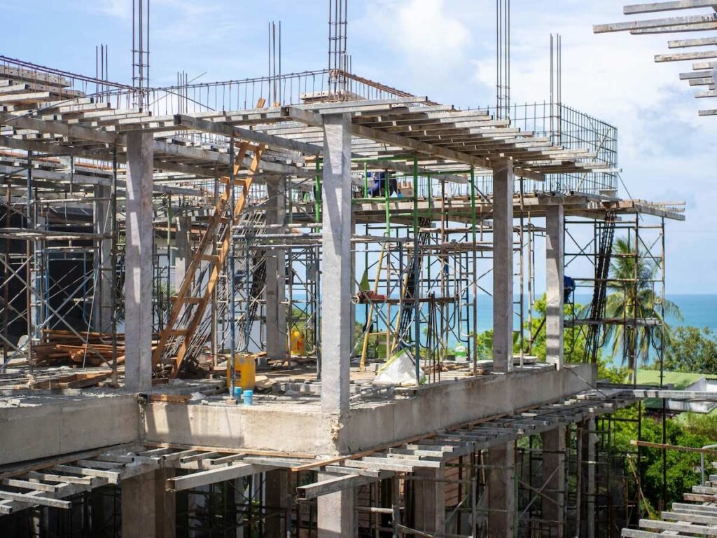
The slope rules layer on top of the elevation rules and are decisive on much of Kathu’s desirable land. Regulations from 2018 prohibit construction on land where the gradient is at or exceeds 35 degrees, treating such land as effectively unbuildable, with additional slope protection, drainage, and engineering obligations applying to gentler but still sloped sites. Phuket’s hillsides are genuinely susceptible to landslides, erosion, and flooding, and in a hilly inland district like Kathu these are not abstract concerns but the central engineering reality of building here. The cost of competent hillside foundation and drainage work is a defining part of any Kathu project budget.
There is a concrete local detail worth knowing. The Kathu District Office maintains its own engineering oversight and inspects properties being built or already built in the district. This means compliance in Kathu is not only a matter of the planning maps but of local inspection, and a design that does not satisfy the district engineer creates a real and immediate problem regardless of what a plot was sold as.
The practical reference points for any Kathu site assessment are the Phuket City Land Use Planning Map for zone classification, a topographic and slope survey for any plot on rising land, the elevation measurement against the controlled bands, the protected-area status relative to the Nakkerd Range, and the relevant Ministerial Regulations. These are the standard reference points, but the rules shift over time, site-specific exceptions exist, and the only reliable approach is to verify the position with the Phuket provincial Department of Public Works and Town and Country Planning office, the Kathu District Office, and a qualified lawyer conducting due diligence before any commitment.
Hillside, slope, and the rule that catches people out
Even on a plot with acceptable zoning, the combination of elevation and slope is what determines whether a Kathu site is genuinely buildable, and it is where buyers most often lose money by committing before checking.
The elevation measurement is unforgiving because it is taken to the top of the building from sea level. A plot at 130 metres in the controlled band allows very little building height before the 140-metre ceiling is reached, which on a sloping site can mean a single low storey or less of usable building once the slope and the roof are accounted for. The relaxed allowance is real, but for a steep elevated plot it can permit far less building than a buyer expects from the headline that the restriction was lifted.
The slope rules compound this. A gradient at or above 35 degrees is treated as unbuildable. Gentler slopes carry cut-and-fill limits, slope protection obligations, and drainage requirements that force stepped or tiered designs and add significant cost. A plot that looks like a buildable hillside view lot can, after a proper survey, prove to allow only a small single-storey footprint in a corner of the land, or nothing at all.
In Kathu, the practical effect is that the elevated land that attracts buyers for its outlook offers the most difficult odds for development of any land type in the district. The Nakkerd Range exclusion, the elevation bands, the slope prohibition, and the active district inspection regime combine to make hillside building here a specialist exercise that has to be assessed plot by plot. A project that hopes to capture a view by building uphill in Kathu needs a slope and elevation survey and a zoning verification before any capital is committed, not after. Any reputable architect will refuse to begin design work without these confirmations.
What a good Kathu design responds to
If the regulations define what cannot be built, the topography and the inland climate define what should be built. Kathu’s hilly setting and its valley microclimate are the dominant design drivers.
On the buildable sloped plots, the design has to work with the slope rather than against it. Stepped and tiered building forms that follow the natural gradient, minimal cut-and-fill, retained natural drainage paths, and foundations engineered for the specific slope and soil are the standard tools. A flat-pad approach that levels a sloping site with heavy cut-and-fill is both regulatorily constrained and a genuine landslide and drainage risk in this terrain. The good Kathu houses are the ones designed around the land’s contour, not the ones that fought it.
The inland valley climate is different from the coastal districts. Kathu sits enclosed by hills, which reduces the coastal sea breeze and can leave the valley floor warmer and stiller than the shore. This makes ventilation design more important rather than less. Cross-ventilation has to be designed deliberately because the site will not supply a constant coastal breeze to rely on. Deep overhangs, shaded openings, high-level exhaust openings to release accumulated heat, and orientation that captures whatever prevailing air movement the specific site receives are all more critical on an enclosed valley or hillside plot than on an exposed coastal one.
Monsoon exposure and drainage are the defining engineering consideration in Kathu. The hilly terrain means that water moves, and a hillside site sheds and receives runoff in ways a flat coastal plot does not. The heaviest rainfall comes late in the year, and a site that is dry and benign in the dry season can become a runoff and erosion problem in the wet season if the drainage is not properly engineered. Stormwater management is not a detail in Kathu, it is central to whether a hillside building survives well over time, and it is one of the areas where the difference between a competent and an incompetent design is most expensive.
Foundation design follows from the hillside geology. Kathu’s hills transition into weathered granite with generally good load-bearing characteristics, but with bedrock that can sit close to the surface and complicate excavation, and with the cut-and-fill limits that constrain how a sloping site can be worked. The flat valley land sits on different and often softer ground that may require piling for anything more than a single storey. Either way, a soil investigation specific to the plot is not optional in Kathu, it is the basis of a safe and compliant foundation design.
Infrastructure and access, the realities
Kathu’s position in the centre of the island gives it reasonable access in several directions. It connects west toward Patong, northwest toward Kamala, and into the central road network that links the rest of the island. For a resident who values being central rather than coastal, Kathu’s location is genuinely convenient, and it avoids the seasonal coastal congestion that affects the resort strips.
Infrastructure in the established valley parts of Kathu is reasonable given the district’s status as a populated working area rather than a remote hillside. Servicing for plots on the developed valley floor is generally less of an obstacle than for remote elevated land. Servicing for elevated and hillside plots, by contrast, can be a significant cost and feasibility factor, and it should never be assumed. Bringing mains services, proper access roads, and drainage to a hillside plot is part of the real cost of building on the elevated land that buyers find most attractive, and it is frequently underestimated.
The airport is toward the north of the island and the southern piers are reachable from Kathu’s central position, but Kathu’s appeal is not access to either. Its appeal is the combination of central location, lower land cost, green hilly setting, and a lived-in local character rather than tourism amenity.
Lifestyle considerations for residential clients
Kathu is not a lifestyle destination in the resort sense. It has limited nightlife, a predominantly local dining scene, and its notable amenities are practical and recreational rather than touristic, including established golf courses and activity venues that have grown up in the valley. Larger shopping and the busier social scene are a short drive away toward Patong and the coast.
What Kathu offers is something different from the coastal districts: an authentic, lived-in part of Phuket with a green hilly setting, lower land cost, and a working-community character. It is quiet in a rustic rather than an exclusive way. The buyers best suited to Kathu are typically those building a primary residence or a long-term home who value the setting, the central location, and the value over coastal prestige and tourism amenity, and who are prepared for the reality that the hillside land which gives Kathu its appeal is also the land the regulations most constrain.
For an architect’s client choosing between Kathu and a coastal district, the question is usually about priorities. A coastal district offers beaches, tourism rental yield, and resort amenity, with coastal-zone regulatory constraints. Kathu offers value, a green central setting, and a real community, with hillside elevation and slope constraints that are at least as demanding as the coastal rules and require specialist site assessment. Neither is simpler than the other; they are constrained differently.
A practical sequence for evaluating a Kathu plot
If you are considering land in Kathu, the order in which you check things matters even more than in the coastal districts, because the constraints here are topographic and not visible from a casual site visit. The wrong sequence, falling for an elevated view plot and then discovering the elevation and slope rules forbid the building you imagined, has cost many buyers significantly.
Start with the title. Confirm the Chanote, the full freehold title, rather than a lesser document, and confirm the title issue date given the pre-2017 condition that applies in the elevation-controlled zones. Then establish the plot’s elevation and its position relative to the protected Nakkerd Range and the controlled elevation bands. Then commission a proper slope and topographic survey with a licensed surveyor for any plot on rising land, because slope is the single most decisive factor in Kathu and cannot be judged by eye. Then verify the zoning classification against the current Phuket planning map and the relevant Ministerial Regulations, and confirm the position with the Kathu District Office given its active inspection role. Only after all of these pass should you commission a soil investigation, a detailed drainage assessment, and the beginning of a feasibility brief.
Most reputable architects on the island, including this practice, will conduct a preliminary land viability assessment before any design work begins. In Kathu this is not a formality. The combination of elevation, slope, protected-area status, and active district inspection means a Kathu plot can look perfect and be substantially unbuildable, and the viability assessment is the stage that determines whether a project is worth pursuing at all.
Final thoughts
Kathu is not the easiest part of Phuket to build on, and anyone who tells you the lifted elevation restriction made it simple has not understood the detail. The protected Nakkerd Range is excluded from the relaxation, the elevation bands carry real conditions, the slope rules are decisive on the desirable land, and the district inspects what gets built. But for the right brief it is one of the more rewarding parts of the island: a green, central, value-priced setting with a genuine community, where a well-sited and well-engineered house on properly verified land can be excellent.
For a buyer who wants a coastal tourism investment, Kathu is the wrong district. For a buyer who wants a primary residence or a long-term home in a green hilly setting at a sensible land cost, and who is prepared to do the topographic and regulatory due diligence properly before committing, it works, and it works well.
If you are weighing a plot in Kathu, the most useful first step is a site assessment that addresses elevation, slope, the Nakkerd Range protected-area position, zoning, drainage, and infrastructure together, not separately. That assessment is offered as the first stage of every project this practice takes on.
Considering land in Kathu, Patong, Kamala, or elsewhere in Phuket? Get in touch for a preliminary land viability assessment. You can also visit our YouTube channel for videos about these areas, and find essential planning advice at www.thetropicalarchitect.com
Note on regulations: zoning, height, altitude, slope, protected-area, and environmental rules are subject to change and to local enforcement variations. The December 2024 elevation change and its exclusion of the protected Nakkerd Range in particular introduced provisions that may not yet be reflected in older online guides. Always verify current rules with the Phuket provincial Department of Public Works and Town and Country Planning office, the Kathu District Office, the Land Office, and a licensed Phuket architect or legal advisor before relying on this guide for any acquisition or build decision.